For over a century, the safety and operation of commercial and passenger fleets rested solely on the human driver’s ability to see, process, and react.
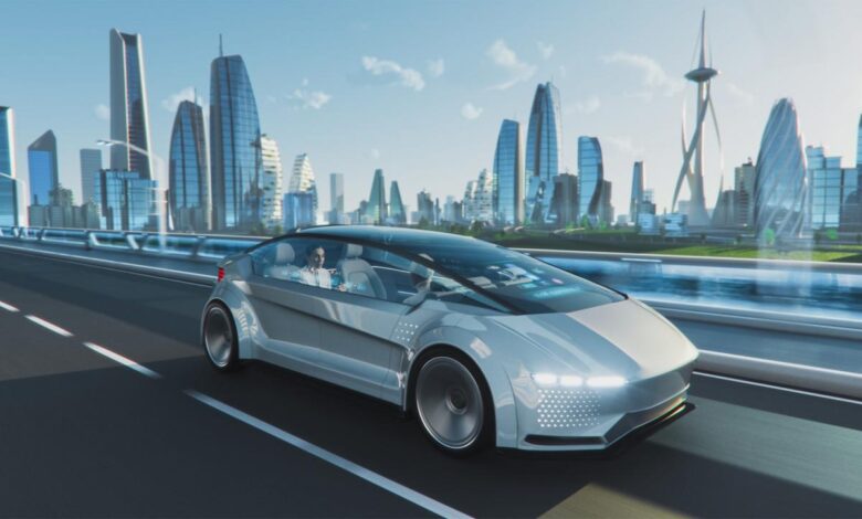
Today, the world is rapidly moving toward Autonomous Fleets, where vehicles—ranging from long-haul trucks and last-mile delivery vans to robo-taxis and mining vehicles—navigate complex environments without human intervention.
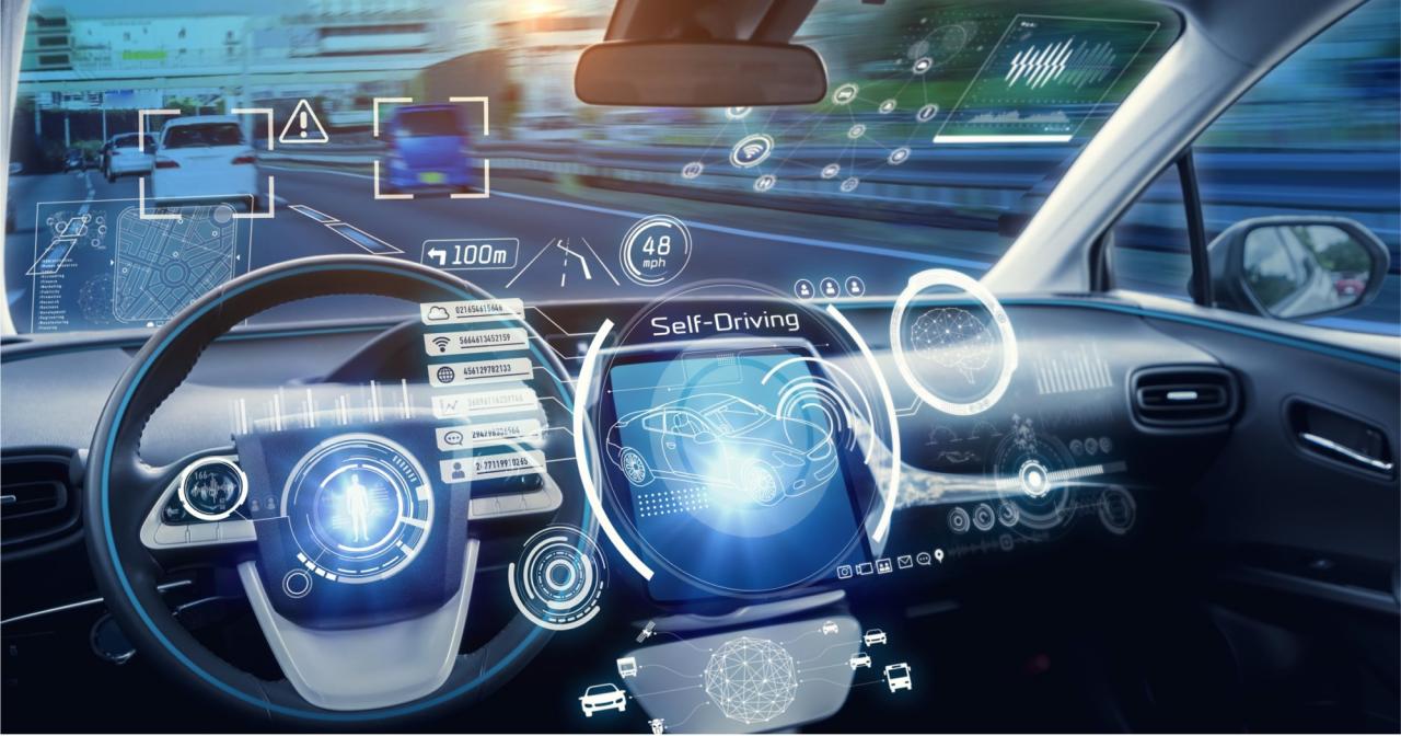
This monumental shift is powered by a sophisticated suite of technologies, but the most crucial component is the sensor array.
Sensors are the eyes, ears, and sense of touch for any autonomous system. They gather the raw data that allows the vehicle’s Artificial Intelligence (AI) to build a real-time, 3D understanding of the world.
By 2025, the performance, cost, and reliability of these perception technologies—primarily LiDAR, Radar, and Cameras—are reaching a critical inflection point, making large-scale commercial autonomous deployment a reality.
The deployment of a successful autonomous fleet hinges entirely on the ability of these sensors to perform flawlessly, under all conditions, all the time.
This detailed exploration will delve into the types of sensors that constitute an autonomous fleet’s perception system, how they fuse data to create flawless spatial awareness, the challenges they overcome, and the economic revolution they are igniting in logistics and transport.
The Sensory Trinity: LiDAR, Radar, and Cameras
A single type of sensor cannot provide the comprehensive, failsafe perception needed for autonomous driving. Instead, autonomous systems rely on Sensor Fusion, the process of combining data from multiple, complementary modalities to create a robust and redundant world model.
A. Cameras (The Eyes)
Cameras are the most human-like sensors, gathering visual data and color information that allows the AI to understand semantics—what an object is.
- High-Resolution and HDR: Modern automotive cameras use high dynamic range (HDR) to manage extreme light conditions, such as driving directly into the sun or navigating dark tunnels. They provide the necessary detail for reading street signs, traffic lights, and lane markings.
- AI Vision: The raw camera feed is processed by Computer Vision AI models trained on millions of images. These models perform object detection (identifying cars, people, and bicycles) and semantic segmentation(labeling every pixel in the image, e.g., sky, road, pavement).
- Cost Advantage: Cameras are relatively inexpensive and mature technology, making them essential for broad deployment.
B. Radar (The Velocity and Range Finder)
Radar is the essential weather-immune sensor, specializing in speed and distance measurement. It works by emitting radio waves and measuring the time it takes for them to bounce back.
- All-Weather Performance: Radar is minimally affected by fog, heavy rain, snow, or dust, providing a crucial layer of redundancy when cameras and LiDAR struggle with low visibility.
- Velocity Measurement: Radar excels at measuring the relative speed of objects—a feature critical for adaptive cruise control and predictive braking—which it does with extreme accuracy thanks to the Doppler effect.
- 4D Imaging Radar: A key innovation for 2025 is the development of 4D imaging radar, which adds the dimension of elevation and higher resolution to the traditional 2D radar, allowing it to better distinguish between an overhead sign and a vehicle ahead, bridging the resolution gap with LiDAR.
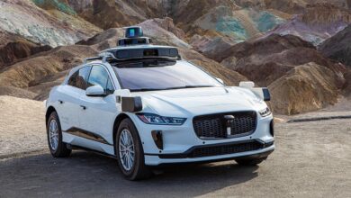
C. LiDAR (The 3D Mapper)
LiDAR (Light Detection and Ranging) is the gold standard for spatial awareness, emitting millions of laser pulses per second and measuring the return time to create a highly accurate, high-resolution 3D Point Cloud of the environment.
- Precise Distance and Shape: LiDAR provides centimeter-level accuracy for measuring distance, enabling the vehicle to determine the exact shape and volume of objects and the free space around them. This is vital for navigating complex maneuvers like automated parking or traversing narrow urban canyons.
- Solid-State Innovation: The initial high cost of mechanical, spinning LiDAR units is being addressed by Solid-State LiDAR technologies. These new units are smaller, cheaper, more robust (no moving parts), and can be integrated seamlessly into the vehicle’s body, driving down the overall cost for fleets.
- Failsafe Redundancy: LiDAR’s direct measurement of geometry is a critical safeguard for the AI. If the computer vision system incorrectly classifies a plastic bag as a rock, the LiDAR’s precise depth and shape measurement can confirm it’s a lightweight object.
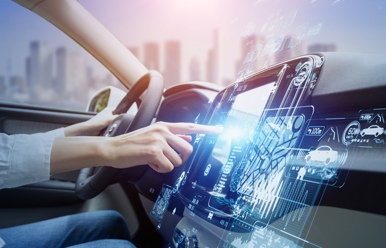
Sensor Fusion: The Intelligence Behind Perception
Raw sensor data is useless; it must be intelligently combined and interpreted. Sensor Fusion is the AI process that takes the strengths of each modality (cameras for identity, radar for speed, LiDAR for precise shape) and mitigates their individual weaknesses to form a single, trustworthy, and continuous understanding of the vehicle’s surroundings.
A. The Fusion Process
- Time Synchronization: The system must ensure that data captured by different sensors at slightly different times is aligned precisely to the millisecond, which is challenging when the vehicle is moving at high speed.
- Data Alignment and Calibration: The position of every sensor on the vehicle must be calibrated perfectly so that a point identified by the LiDAR aligns exactly with the corresponding pixel in the camera image and the radar return.
- Weighted Decision-Making: The AI assigns confidence scores to the data from each sensor based on the current environment. For instance, in heavy fog, the AI will place a higher confidence weight on the Radar and less on the Camera, ensuring reliable operation despite poor visibility.
B. Local and Global Mapping
Sensor data does more than just inform immediate driving decisions; it constantly updates the vehicle’s spatial knowledge base.
- Occupancy Grids: The combined sensor data is used to create occupancy grids, which divide the world into small 3D cubes, identifying which cubes are occupied by objects and which are free space, crucial for planning paths and avoiding obstacles.
- High-Definition (HD) Mapping: Autonomous fleets rely on highly detailed maps (centimeter-level accuracy). The fleet vehicles constantly collect new sensor data and upload it to the cloud, allowing the central AI system to update and refine the HD maps in real-time. This crowdsourcing of perception is a major benefit for large, distributed fleets.
Specialized Sensors and Positioning Technologies
Beyond the main three, autonomous fleets utilize specialized sensors for positioning and functional monitoring, essential for professional-grade deployment.
A. Global Navigation Satellite Systems (GNSS)
Standard GPS is not accurate enough for autonomous driving. Fleets use advanced GNSS receivers for highly accurate positioning.
- RTK-GPS/Differential GPS: These systems use correction signals from ground-based reference stations or satellites to achieve Real-Time Kinematic (RTK) accuracy, pinpointing the vehicle’s location to within a few centimeters. This is vital for accurate lane-keeping and docking maneuvers.
B. Inertial Measurement Units (IMUs)
The IMU acts as a backup for positioning when satellite signals are temporarily lost (e.g., in tunnels, parking garages, or dense urban canyons).
- Dead Reckoning: The IMU contains gyroscopes and accelerometers that track the vehicle’s precise pitch, yaw, roll, and acceleration. By calculating these changes over time, the IMU can maintain a highly accurate estimate of the vehicle’s position and orientation until the GNSS signal is reacquired.
C. Ultrasonic Sensors
These small, low-cost sensors are crucial for short-range detection, especially at low speeds.
- Parking and Proximity: Ultrasonic sensors use sound waves to measure very short distances (a few meters) and are primarily used for low-speed maneuvers like automated parking, maneuvering in tight loading docks, and detecting curb edges or small objects near the vehicle’s body.
Deployment Challenges for Autonomous Fleets (2025 Outlook)
The shift to fully sensor-dependent fleets introduces unique challenges that the industry is actively addressing by 2025.
A. Sensor Robustness and Maintenance
- Cleaning and Protection: The vast number of external sensors (often over 20 per vehicle) are susceptible to dirt, ice, and road grime. Fleets require sophisticated active cleaning systems (washers, wipers, blowers) that operate reliably across all climate zones to ensure the sensors’ field of view remains unobstructed.
- Calibration and Diagnosis: If a sensor is bumped or replaced, its position must be recalibrated with centimeter precision relative to all other sensors. Fleets need automated, over-the-air (OTA) diagnostic tools to detect misalignments or degradation without requiring a trip to the depot.
B. Data Processing and Computing Power
- High-Performance Computing (HPC): The simultaneous processing of massive data streams—from multiple high-resolution cameras, high-frequency LiDAR, and Radar—requires immense computing power. The onboard computer must be robust, energy-efficient, and capable of handling complex AI algorithms in real-time, often necessitating specialized automotive-grade AI chips.
- Data Labeling and Training: The AI models that interpret sensor data require constant training on new and diverse data (different weather, new construction zones, novel traffic behaviors). Fleets generate petabytes of sensor data that must be efficiently filtered, labeled (by humans), and fed back into the training loop, forming the backbone of fleet intelligence.
C. Cost of Redundancy
A safe autonomous system requires redundancy—having two or three systems capable of performing the same critical task.
- The Cost-Function Trade-off: While sensor costs are decreasing, the requirement for triple or quadruple redundancy (e.g., multiple LiDAR units, two independent computing platforms) significantly increases the initial vehicle price, which fleet operators must offset with guaranteed long-term operational savings.
- Standardization: Lack of standardized interfaces and data formats among different sensor manufacturers makes integration difficult and costly for the fleet builder, emphasizing the need for industry alignment.
Conclusion
The autonomous fleet is the undeniable future of logistics, driven by the compelling economic benefits of reduced labor costs, 24/7 operation, and fuel efficiency. But this future is physically manifested through its sensor array.
These sensors—the trinity of LiDAR, Radar, and Cameras, augmented by precise GNSS and IMU units—are collectively the central nervous system of the driverless vehicle. They provide the necessary, continuous, and highly redundant perception that transforms a conventional truck into a mobile, intelligent computing platform.
The current technological focus for 2025 is less on introducing entirely new sensor types and more on maturing and optimizing existing technologies.
This includes the mass commercialization of solid-state LiDAR to achieve cost parity, the deployment of 4D imaging radar to bridge the resolution gap, and the development of highly robust, self-cleaning, and self-calibrating sensor systems essential for harsh fleet operating conditions.
Crucially, the advancement of Sensor Fusion AI is the true intelligence multiplier, ensuring that no single sensor failure or adverse weather condition can cripple the vehicle’s ability to navigate safely.
The massive data collected by these fleets, continually feeding back into the AI training and HD map updates, creates a powerful virtuous cycle where the entire fleet gets smarter with every mile driven.
The efficiency, reliability, and safety gains promised by the autonomous future will ultimately be delivered not by software alone, but by the relentless precision and interconnectedness of these sophisticated perception sensors. They are, quite literally, the eyes that will keep the global economy moving.